What are the elevation gains on your Kilimanjaro Climb? There are two factors that will determine the elevation gains on your Kilimanjaro trip. What route you choose to take and how many days you will do it in. I personally designed our itinerary for the best safety and success. Check it out here.
Our Unique Lemosho Route Itinerary
After helping over 3,000 people in the summit of Kilimanjaro, we have developed our own unique itinerary on the Lemosho route on the mountain as this route gives us a 95% success rate. Our itinerary will give you the best chance of reaching your goal of the roof of Africa, while also allowing you to enjoy the journey.
Daily Elevation Gains on the Lemosho Route
We will showcase the elevation gains on our Lemosho Route itinerary up Kilimanjaro. However, if you chose less days, you are going to see far higher jumps in altitude. This will make a big difference in your acclimatization and safety. Why not join one of our upcoming trips and climb with Kilimanjaro’s Number 1 Guide. We will make sure you have the tools to make a safe and successful attempt on Kilimanjaro.
Day 1). Arusha – The gateway to safari and Kilimanjaro
You will arrive at Kilimanjaro International Airport and we will transfer you to your hotel in Arusha. We use the Sheraton hotel or similar in Arusha. You might not think it but you already started your acclimatization on your flight. The cabin pressure on your flight would normally be set around 2,000m/ 6,561 feet. Then, you will continue your acclimatization in Arusha as it sits at 1,400m/ 4,593 feet. At this elevation, there is 12% less oxygen than at sea level.
Remember, you can always come in early, recover from jet lag, time zone changes and gain extra acclimatization for the climb by climbing Mount Meru with us. Depending on where in the world you live, you may need more time than just one night in Arusha. We have people joining our climbs from around the world. It is important so make sure you are rested and well hydrated before you start the climb, in order to start off on the right foot.
Day 2). 3 Hour Drive to the Lemosho Gate and 3 Hours Hiking
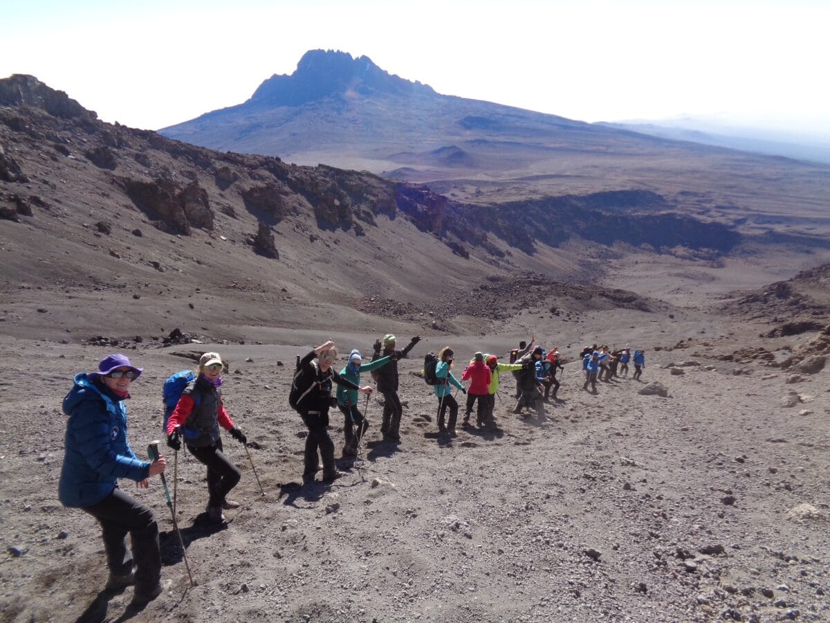
You will be up early for breakfast as the goal is to leave by 8 am for the three and a half hour drive to the Lemosho Gate. The Gate sits at 2,250m/ 7,381 feet. On our climbs you will have a full 3 course meal for lunch at the gate before you get back into the vehicle for 25 minute drive to the start of the trail. The start of the trail is at 2,300m/ 7,545 feet. After trekking for 3 hours you will then reach Big Tree Camp at 2,800m/ 9,186 feet. You are now at high altitude, therefore, it is important to take your time with everything you do. You will hiking up 500m/ 1,640 feet and covering 3.9 miles/ 6.2km on this day. Watch video from Day 1 on the Lemosho route.
Day 3). The Journey up to the Shira Plateau
Breakfast will be served at 7 am. Your bags will need to be packed and ready, so tents can be dismantled and moved to the next camp, Shira Camp 1, at 3,500m/ 11,500 feet. At 8 am you will be moving, hiking through the rain forest. Once you hit 3,000m/ 9,842 feet, you will exit the rain forest, and the route up to the Shira Plateau reveals itself. Today, you ascend 700m/ 2,296 feet over 5.7 miles/ 9.1km. Watch video from Day 2 on the Lemosho route.
Day 4). Moving Across the Shira Plateau
Today is an easier hike, but you are still at high altitude and therefore you still need to be drinking 4 to 5 liters of water. The route today leads across the Shira plateau to Shira Camp 2 at 3,900m/ 12,795 feet. Once you arrive at Shira Camp 2 you will have lunch and then continue up to 4,000m/ 13,123 feet for additional acclimatization. After this acclimatization hike, then you will return for the afternoon and evening in Shira Camp 2. Today, you will cover 500m/ 1,640 feet for ascent and 100m/ 328 feet of descent, over a distance of 6.2 miles/ 10km. Watch video from Day 3 on the Lemosho route.
Day 5). The Critical Acclimatization Day
Today is one of the big acclimatization days. You will need to leave camp at 8am for the 4 hour hike up to the Lava Tower at 4,640m/ 15,091 feet. Our team will have the mess tent erected at the lava tower for you to rest in the shade and be served a three course meal. After lunch, then you will descend all the way down to Barranco Camp, at 3,900m/ 12,795 feet. This is a long day where you hike up 740m/ 2,428 feet and also down 740m/ 2,428 feet and cover 6.7 miles/ 10.8km. Watch video from Day 4 on the Lemosho route.
Day 6). The Barranco Wall to the Karanga Camp
After a good nights rest, then you will be right back at it! For many trekkers, today is a favorite day, as you climb up and over the Barranco Wall. We think that the Barranco Valley is the most beautiful valley on Kilimanjaro. This is an easier day and the Barranco wall should not scare you. Most people are ready to do it again after they complete it as they have so much fun scrambling through the rock in the amazing and unique place.
The elevation gain on the Barranco Wall is 300m/ 984 feet. Once on top of the wall, you make a series of ups and downs before dropping 140m/ 460 feet, into the Karanga Valley. From there, you will continue moving back up the trail another 120m/ 400 feet, before arriving at the Karanga Camp at 4,050m/ 13,287 feet. The total amount of elevation gain today is 450m/ 1,476 feet. Also, the descent is a total of 220m/ 721 feet. Therefore, you will cover a distance of 3.5 miles/ 5.6km today. Watch video from Day 5 on the Lemosho route.
Day 7). High Camp and Launching Pad for the Summit
Today the team will move up to one of two points. Barafu High Camp at 4,650m/ 15,255 feet or Kosovo Camp 4,900m/ 16,076 feet. The goal is always to get to the Kosovo Camp, however this is weather dependent. This is putting you in to the best position for the early morning hours for your summit attempt. The goal is to get to high camp early to aid in the acclimatization process.
Once you reach high camp, then you will be served a full three course meal. Then you will have time to get your clothing ready for the summit attempt before trying to get as much rest and sleep as possible. You will be up again at midnight, preparing for the push to the summit. Today is all uphill, 650m/ 2,132 feet or 900m/ 2,953 feet if we go up to Kosovo Camp. Aiming to arrive into high camp around mid day. You will cover 2.7 miles/ 4.3km today, getting into high camp. Watch video from Day 6 on the Lemosho route.
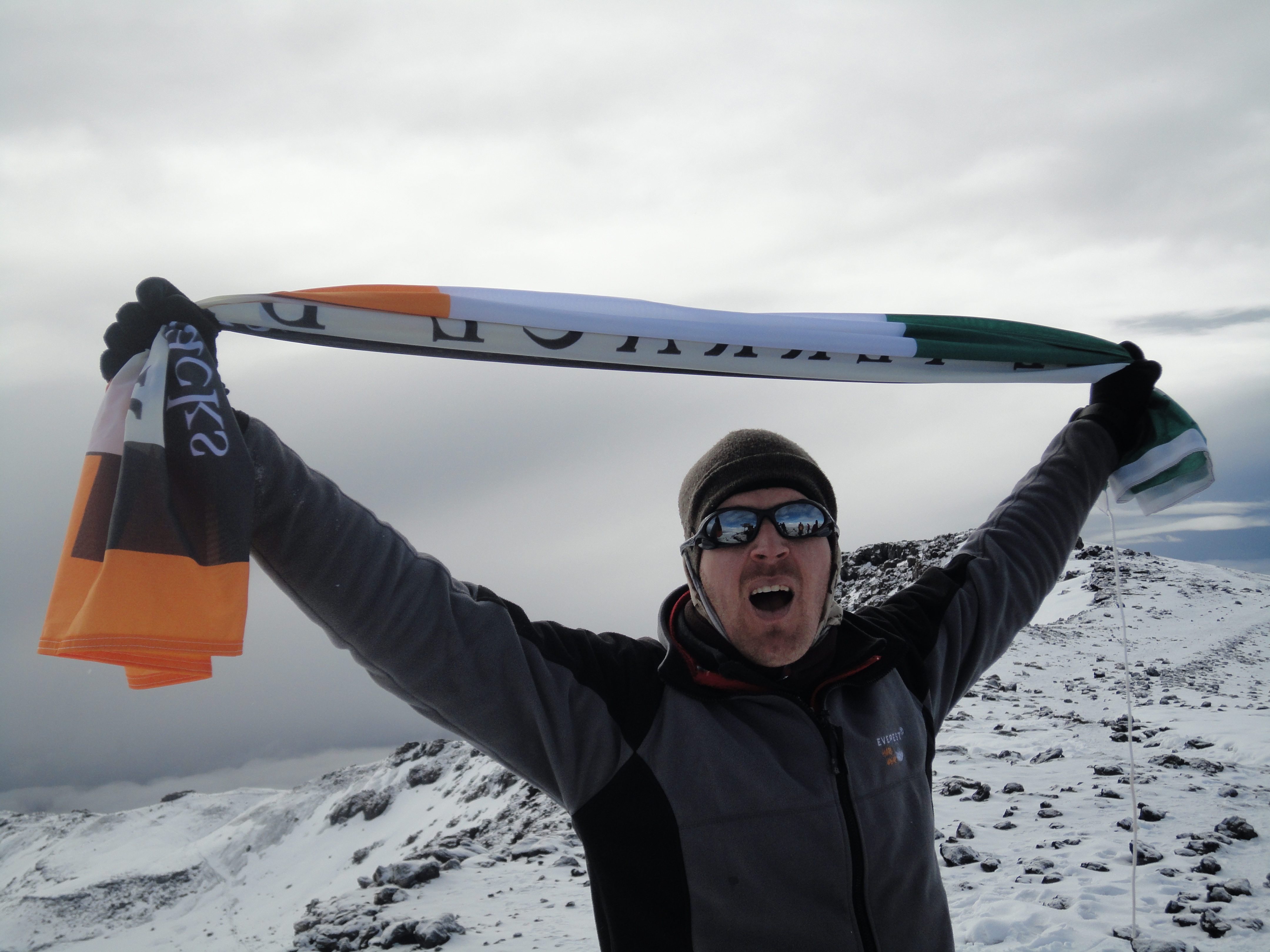
Day 8). One of the Biggest Trekking Days of your Life
This is it, all that you have been preparing for over the past year or more! Today is your summit night , with a full day of hiking up and down the mountain. Summit day is approximately a fourteen hour journey. You will travel up to the summit 1,245m/ 4,084 feet or 1,095m/ 3,592 feet if we leave from Kosovo Camp, and then drop down 2,795m/ 9,170 feet. This is a VERY tough day, even for the most seasoned trekker! Therefore, you MUST be prepared!
After reaching the summit and heading back down to the camp, then you will get a two hour break. There, you will have time for a full lunch, some rest and time to pack up your bags. Then, you will be moving down to Mweka Camp, at 3,100m/ 10,170 feet. On this very long day, you will cover a distance of 11.2 miles/ 18.1km. Watch video from Day 7 on the Lemosho route.
Day 9). The Rewarding Walk Down Kilimanjaro
After an amazing nights sleep at lower altitude, you will begin your final day on the mountain. Today, you will drop from Mweka Camp at 3,100m/ 10,170 feet, down to the Mweka Gate at 1,676m/ 5,500 feet. This is a beautiful steep walk, down hill through the rain forest. However, your legs will be tired from the day before! You will descend down 1,424m/ 4,671 feet today and will cover a total distance of 5.8 miles/ 9.3km. Watch video from Day 8 on the Lemosho route.
So now you have the lowdown on what we believe from our experience is the best route up the mountain – The Lemosho Route.
The elevation profile for Lemosho Route is quite advantageous as it offers a slow and steady climb up the mountain, allowing for adequate time to acclimatize along the way. It also provides a less crowded experience on the mountain due to its longer duration.
By extending your time on the trail, you can fully appreciate Kilimanjaro’s stunning views. Thus, making it arguably one of the most rewarding hikes in Africa.
But let’s further explore Mt. Kilimanjaro and its elevation in more detail and look at some other routes, how this African peak compares to others worldwide, some interesting facts about the mountain, and more.
Kilimanjaro Height
Mount Kilimanjaro stands proudly as the highest peak in Africa. Standing tall at 5,895 meters (19,341 feet) above sea level, it is also the world’s highest free-standing mountain. Uhuru Peak, Kilimanjaro’s highest summit, is the main destination for most climbers.
Kilimanjaro’s summit is just one of a trio of distinct volcanoes, Kibo, Mawenzi, and Shira. Kibo crater stands in the middle and is the highest peak. Mawenzi stands 5,149 meters (16,893 feet) high to the east and Shira 4,005 meters (13,140 feet) high to the west.
Geographical Location
Mount Kilimanjaro is a stratovolcano (a conical volcano) located in the Kiliman located in Northeastern Tanzania, East Africa, near the Kenya border. It’s part of the Kilimanjaro National Park and is a protected area.
Comparison with Other Famous Mountains
Have you heard of the Seven Summits? The Seven Summits are the seven highest mountains on each continent. They consist of Mt. Everest in Asia, Mt. Kilimanjaro in Africa, Mt. Elbrus in Europe, Mt. Denali in North America, Mt. Aconcagua in South America, Vinson Massif in Antarctica and Carstensz Pyramid in Oceania/Australia.
Mount Kilimanjaro ranks fourth in height of the Seven Summits, coming in between Mt. Elbrus (5,642 meters or 18,510 feet) and Denali (6,194 meters or 20,322 feet). Despite being lower than some of the world’s most notorious peaks, Kilimanjaro still stands as one of Earth’s most iconic mounts.
| Summit | Height (meters) | Height (feet) | Country | Continent |
| Mount Everest | 8,848 | 29,029 | Nepal/China | Asia |
| Aconcagua | 6,962 | 22,841 | Argentina | South America |
| Denali (Mount McKinley) | 6,190 | 20,310 | United States | North America |
| Kilimanjaro | 5,895 | 19,341 | Tanzania | Africa |
| Elbrus | 5,642 | 18,510 | Russia | Europe |
| Vinson Massif | 4,892 | 16,050 | Antarctica | Antarctica |
| Puncak Jaya (Carstensz Pyramid) | 4,884 | 16,024 | Indonesia | Oceania |
Different Climbing Routes On Kilimanjaro And Their Elevation
We’ve pretty much covered the Lemosho route in-depth, and we’ve discussed why we believe it’s the best route for most climbers. However, several other Kilimanjaro routes can be taken, with elevations varying from route to route.
Marangu Route
The Marangu Route, or the “Coca-Cola” route, is so called because of the refreshments offered at the huts on this route. Dubbed the easiest way up the mountain, it is often the route of choice for more inexperienced climbers. But with its high elevation gains each day and lack of acclimatization time, it is not necessarily the best. This is reflected by the low success rate due to altitude sickness. The trailhead starting at Marangu Gate is 1,843 meters (6,047 feet), and the elevation gain is 4,052 meters (13,384 feet).
Machame Route
The Machame Route is one of the most popular routes and offers spectacular views, but it tends to be more crowded than the Lemosho Route. It is also known as the “Whiskey” route because of the difficulty involved. The trailhead starts at Machame Gate, 1,640 meters (5,380 feet), and reaches an elevation gain of 4,255 meters (14,051 feet).
The Umbwe Route
The Umbwe Route is known for its steep elevation gains, which makes it one of the most challenging routes up Kilimanjaro, despite being one of the shortest paths. However, it’s important to note that this route provides very little opportunity for acclimatization, so we don’t recommend it for inexperienced hikers or those who are new to high-altitude climbing. Starting at Umbwe Gate, 1,800 meters (5,906 feet), the elevation gain is 4,095 meters (13,435 feet).
Rongai Route
There are several other routes, but the last one we will discuss is the Rongai Route. Like Lemosho and Machame, this route emphasizes acclimatization by having more gradual elevation gains spread out over a longer time. However, as you tackle this route from the north side, you’ll miss out on some of the most spectacular views of the mountain. The trailhead starts at Rongai Gate, 1,950 meters (6,398 feet), and reaches an elevation gain of 3,945 meters (13,033 feet).
Altitude Sickness And Its Impact On Elevation Gain
Climbing Kilimanjaro isn’t something that should be taken lightly, and though, as we mentioned earlier, we have a 95% success rate for summiting, altitude sickness is something to factor in.
Altitude sickness (also known as Acute Mountain Sickness or AMS) can be a serious condition that’s caused by climbing too high too quickly and not allowing your body enough time to acclimatize.
Fortunately, you are in good hands when you climb Kilimanjaro with Ian Taylor Trekking, as we are old hands at what we do with years of experience in high-altitude climbing.
We take the necessary precautions to ensure that you don’t succumb to altitude sickness, such as taking regular rest and going slow enough that your body has time to acclimatize.
We check oxygen saturation and heart rates morning and evening for each climber and ensure that our climbers never make more than 700 meters jumps in altitude in one day.
Generally speaking, the longer routes, such as the Lemosho route, offer more gradual ascents, allowing more time for acclimatization. With patience and proper preparation, you should have no trouble achieving success on Kilimanjaro.
Tips For Successful Elevation Gain On Kilimanjaro
To climb Mount Kilimanjaro is no easy feat and requires physical preparation beforehand to ensure a successful summit.
Below are some tips for making sure that your ascent to the roof of Africa is as successful as possible:
- Make sure you’re physically fit before attempting any of Kilimanjaro’s routes.
- Start training early and focus on building up endurance, strength, and cardiovascular health.
- Prepare mentally by visualizing yourself reaching the summit and making it through any challenging moments that may arise during your climb.
- Pack the right gear and supplies.
- Stay hydrated throughout the trek.
What’s the Difference Between Elevation and Ascent?
When climbing Mount Kilimanjaro, you’ll look at two measurements: elevation and ascent. The elevation is how high the peak of the mountain is in relation to sea level, while the ascent measures how far up the mountain one has climbed.
And you’ll also soon notice that the ascent isn’t all gain; you’ll be ascending, descending, and ascending again – sometimes it will seem like two steps forward, one step back!
Interesting Mount Kilimanjaro Facts
Standing on the roof of Africa is an amazing and unforgettable experience, but let’s finish off by looking at some interesting facts about Kilimanjaro:
- The name Kilimanjaro likely comes from the Swahili phrase “Kilima Njaro,” which means “Mount of Greatness.”
- The first recorded successful ascent to the summit was made in 1889 by German geographer Hans Meyer and Ludwig Purtscheller, an Austrian mountaineer.
- Mount Kilimanjaro was declared a UNESCO World Heritage Site in 1987.
At the ripe age of 89, Anne Lorimor made history as the oldest individual to ascend Mount Kilimanjaro.
Elevation Gains on Your Kilimanjaro Climb
We hope this post about elevations gains on Kilimanjaro was helpful. If you want more information or to start planning your trip up Kilimanjaro, then GET IN TOUCH today! We have the expert information you need to make your trip a success. Likewise, we have the team in place to give you the best experience in reaching Africa’s Highest Point! Follow us on Instagram.